


GR: NY21858 07555 Height: 935m / 3069ft
Summary: Broad Crag is one of the heights that makes up the Scafell Pikes, it lies between Scafell Pike itself and Great End, just to the north of Ill Crag. Whilst Wainwright did include it on his first and second lists it never made it as a separate chapter in the Pictorial Guides. There may be one or two reasons for its omission. Firstly, the fell was not a measured height on his 1 inch maps which he used when compiling his lists of potential fells, a criteria he nearly always used for including fells. Secondly, this fell has little in the way of merit apart from its height, the ground is very rough and lacking in interesting features. Combine this with the fact that Broad Crag is in close proximity to Scafell Pike and Great End it would have been difficult to design a chapter with maps and illustrations that justified the page space. After all, Wainwright admits that book four, The Southern Fells was full to capacity already so including two other fells, Broad Crags and Ill Crag (as he couldn’t have included one without the other) would have been impractical.
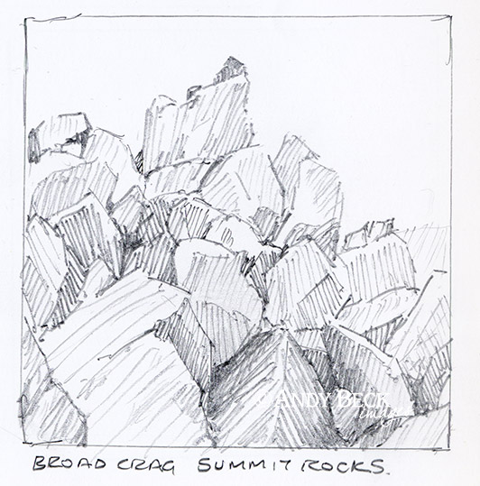
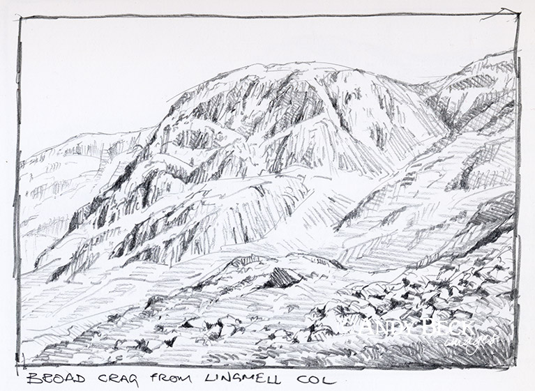
Topographical details: In the Scafell Pike chapter on the Broad Crag page (Scafell Pike 9) Wainwright gives the fell a height of 3054′ as mentioned above, there was no height given on either his 1 inch maps nor was there a height on the 1:25,000 maps of the time. He took this height from a benchmark near the summit shown on the older 6 inch scale map. This height has now been updated to 935m / 3069ft. The highest point of the fell is obvious amongst a jumble of rocks and boulders. There is no distinct path to the top of the fell, in fact as in AW’s day many walkers just pass this summit by as they head to or from Scafell Pike on the well worn path about 80m south of the fell top.
Points of interest: Broad Crag lacks interesting features either natural or man made. As can be expected given that it reaches over 3000′ the views from the summit on a fine day are exceptional.
Tarns: There are no tarns or even any sign of water near the summit, the nearest tarn being on the northern slope of Broad Crag adjacent to the corridor route near Middleboot Knotts.
Waterfalls: An impressive fall (unnamed) can be found at the top of Piers Gill.
Adjoining fells: Scafell Pike lies 500m (approx) to the south-west. Great End is 1km (approx) to the north-east. Ill Crag is 400m (approx) to the south-east.
Nearest facilities: Car parking, if approaching the fell from the north there is limited parking (free) in Seathwaite along the roadside but do not obstruct farm or emergency vehicle traffic. Be warned, the parking area here can get very busy, so get there either very early or late in the afternoon. There is parking in a field near Seathwaite farm for a small fee. If walking in from the west there is car parking at Wasdale Head where food, accomodation and camping can be found at The Wasdale Inn. There is also camping available at the National Trust campsite.
Star rating: [usr 2.2] Broad Crag in general lacks interest and only its situation as one of the Scafell Pikes and its altitude give it much merit.
Check walks on this fell:
12/6/09 Glaramara and the Scafell Pikes